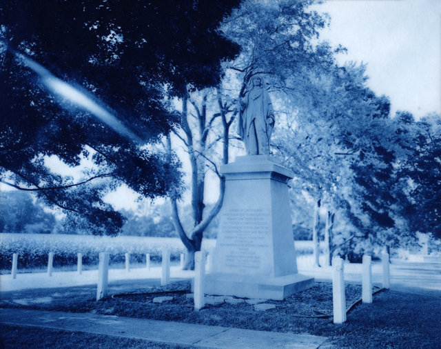
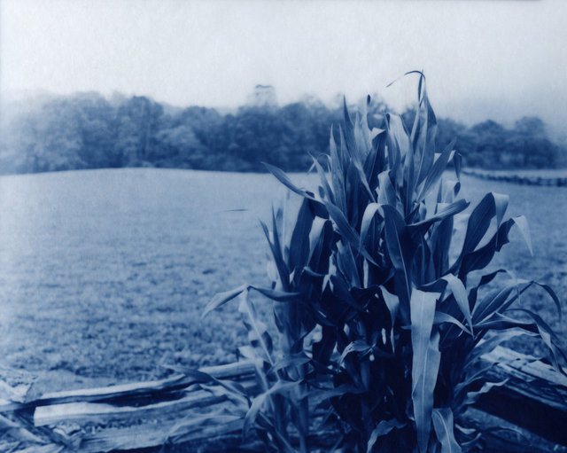
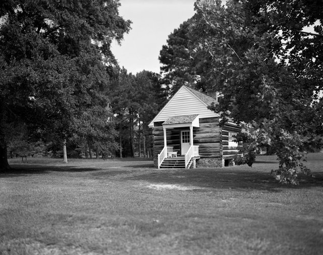
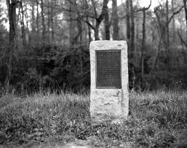
Chief Menominee Memorial, Plymouth, Indiana - 2010.
This statue is dedicated to Chief Menominee, a leader of the Potawatomi Nation, who sought to maintain his people’s right to live on their homeland. The Potawatomi “Trail of Death”, their removal to Kansas, began at this site. The Chief Menominee Memorial is the only statue dedicated to a Native American person that was funded by a federal grant. New Cyanotype Print on Wyndstone Vellum from the original 8"x10" negative
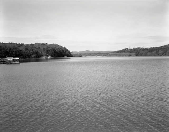
Keowee Town, Salem, South Carolina – 2006
Keowee Town, the former capital of the Lower Cherokee Nation lies below Lake Keowee. The Duke Power Company formed the lake in 1971 in order to generate hydroelectric power for their Keowee Hydro Station. New Cyanotype Print on Wyndstone Vellum from the original 8"x10" negative
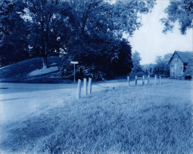
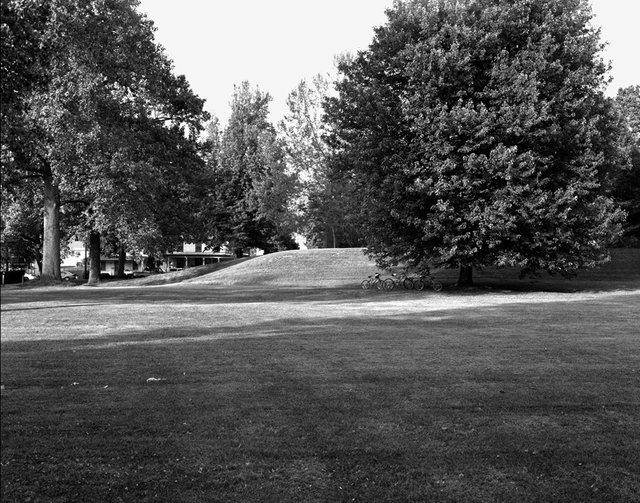
Norwood Mound, Norwood, Ohio – 2010
The Norwood Mound is an unexcavated Indian mound located in the city’s Water Tower Park. Little is known about its origins. New Cyanotype Print on Wyndstone Vellum from the original 8"x10" negative
Nikwasi Mound, Franklin, North Carolina – 2005
The Nikwasi Mound is believed to have been constructed around 1000 CE by the Mississippian culture peoples, and was later the center of the Cherokee Town of Nikwasi. The Cherokee Council House and the sacred fire that the Cherokee kept burning from year to year once stood atop the mound. Members of the Eastern Band of Cherokee still tend this land. New Cyanotype Print on Wyndstone Vellum from the original 8"x10" negative
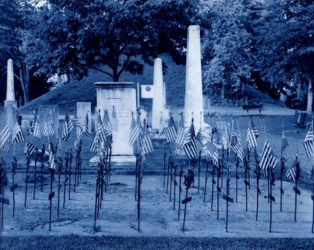
Chota Memorial, Vonore, Tennessee – 2007
The Eastern Band of Cherokee built the monument in the background of this photograph in order to honor the former town of Chota, the capital of the Cherokee Nation from the 1740’s to 1788. The gravestone in the foreground marks the burial site of Oconostota, a revered Cherokee leader and warrior. In the 1960’s his remains were found during the excavations performed before the area was flooded to form Tellico Lake. New Cyanotype Print on Wyndstone Vellum from the original 8"x10" negative
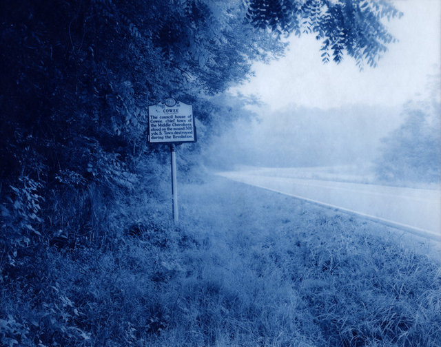
Cowee, Franklin, North Carolina – 2006
This historical marker reads, “The council house of Cowee, chief town of the Middle Cherokees, stood on the mound 300 yds. S. Town destroyed during the Revolution”. New Cyanotype Print on Wyndstone Vellum from the original 8"x10" negative
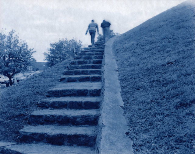
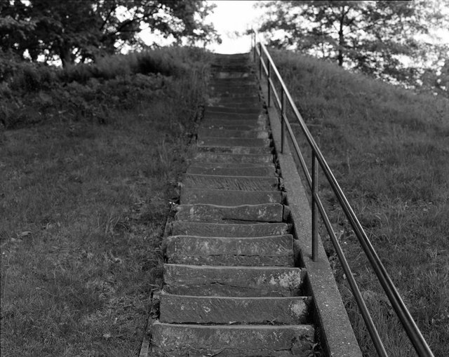
Criel Mound, South Charleston, West Virginia – 2005
This Adena Burial Mound, one of the few mounds in the U.S. featuring a spiral staircase, is the central focus of the town of South Charleston, West Virginia. The top of the mound was leveled in the 1840’s in order to form a judge’s stand for the horse races that occurred around its base. Today, it is located in the heart of South Charleston, Staunton Park, a gathering place for community events within the city. New Cyanotype Print on Wyndstone Vellum from the original 8"x10" negative
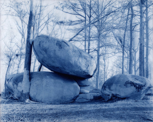
Shaking Rock Park, Lexington, Georgia – 2005
Shaking Rock Park was formerly a campsite to the Cherokee and Creek people. The park derives its name from a 27-ton boulder that balances on another boulder and could once be moved by hand. New Cyanotype Print on Wyndstone Vellum from the original 8"x10" negative
Conus Mound, Marietta, Ohio – 2005
American Revolutionary War soldiers’ graves stand before this conical Adena burial mound known as the Conus Mound. Conus is one of a series of ancient earthworks within the city that were built between 800 BCE and 700 CE. In 1976, the Junior League of Marietta buried a time capsule on top of the mound, which will be will be unearthed and opened in 2076. New Cyanotype Print on Wyndstone Vellum from the original 8"x10" negative
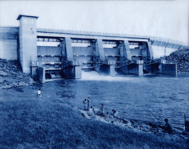
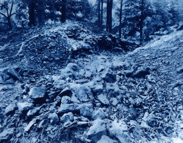
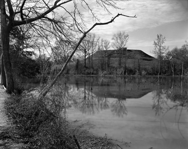
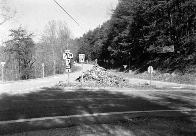
Coosawattee Town, Ellijay, Georgia – 2009
In 1977, The Army Corps of Engineers formed Carter’s Lake on the former site of the Cherokee town, Coosawattee. This photograph shows the re-regulation dam built there. In 1838, the Cherokee were removed from this area to nearby Fort Hetzel, where approximately 1100 Cherokee people were held before their journey on the “Trail of Tears” to Oklahoma. Many Cherokee died in squalid Removal Forts, such as Fort Hetzel, before their forced marches could begin. New Cyanotype Print on Wyndstone Vellum from the original 8"x10" negative
Gnadenhutten Cemetery, Gnadenhutten, Ohio – 2005
On March 8, 1782, ninety Christian Delaware Indians were massacred by a group of Pennsylvania militiamen on this site. Today, visitors to Gnadenhutten Cemetery can see the mass grave of the martyred Indians and pose as an Indian for a snapshot. New Cyanotype Print on Wyndstone Vellum from the original 8"x10" negative
Red Clay Council House, Cleveland, Tennessee – 2007
Red Clay State Park in Cleveland, Tennessee features a replica of the Council House at Red Clay, the seat of Cherokee government from 1832 to 1838. The council grounds were the last place the Cherokee council met before their forced removal by federal troops under the command of General Winfield Scott in 1838. New Cyanotype Print on Wyndstone Vellum from the original 8"x10" negative
Old Stone Fort, Archeological Park, Manchester, Tennessee – 2008
This is an excavation site within Old Stone Fort Archaeological Park. The park features a 2,000 year old “stone fort”-- a 1.25 miles long enclosure consisting of mounds and stone walls. It is believed to have been a sacred ceremonial center to Native people. New Cyanotype Print on Wyndstone Vellum from the original 8"x10" negative
Ashland Central Park Mounds, Ashland, Kentucky – 2005
A series of six Indian Mounds are located in this park in Ashland, Kentucky. The mounds have not been excavated, so their cultural origin is unknown. New Cyanotype Print on Wyndstone Vellum from the original 8"x10" negative
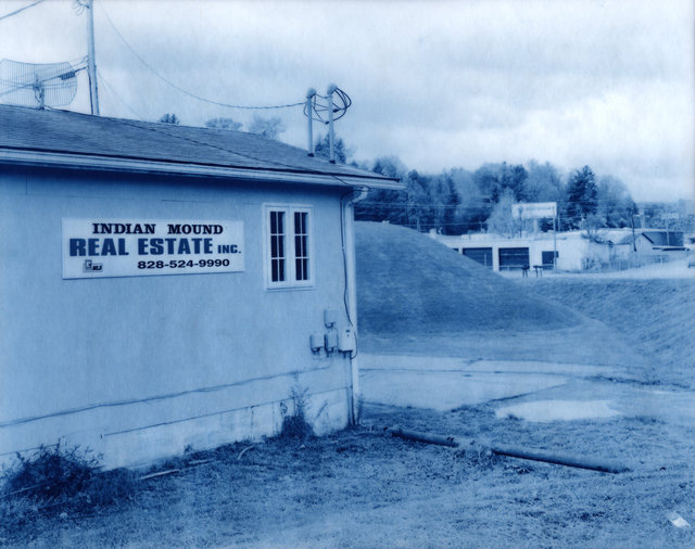
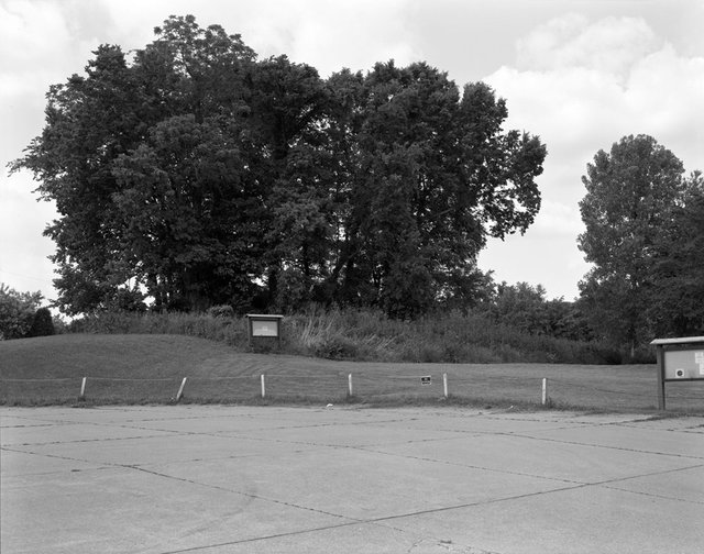
Porteus Mound, Coshocton, Ohio - 2010
Part of this mound was destroyed in 1980 during a road construction project. A nearby marker placed by the Coshocton High School class of 1982 states that the mound was used for ceremonial purposes rather than as a burial mound and was built between 800 B.C. and 500 A.D. New Cyanotype Print on Wyndstone Vellum from the original 8"x10" negative
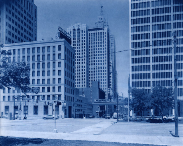
Fort Detroit, Detroit, Michigan - 2011
Fort Detroit, a fort controlled by the British in 1763, formerly stood where the intersections of Griswold and Larned Streets stand currently. Ottawa leader Pontiac and his followers attacked the fort in attempt to force the British out of the area that was home to Ottawas, Ojibwas, Potawatomis, Hurons and other Great Lakes Indian Nations. New Cyanotype Print on Wyndstone Vellum from the original 8"x10" negative
Kituwah Mound, Bryson City, North Carolina – 2005
Kituwah is known as the birthplace of the Cherokee Nation. In the 1830’s the land was taken from the Cherokees and subsequently farmed. In 1996, it was purchased by the Eastern Band of the Cherokee Nation, who has been protecting it from development. The slight hill in the back of the photograph is the Kituwah Mound, which was greatly reduced in size during the years it was used as farmland. New Cyanotype Print on Wyndstone Vellum from the original 8"x10" negative
Wright Brothers Memorial Mound Group, Dayton, Ohio – 2011
Six Mounds, believed to be Adena in origin, are located on the Wright-Patterson Air Force Base. A memorial to the Wright Brothers stands nearby. New Cyanotype Print on Wyndstone Vellum from the original 8"x10" negative
Miamisburg Mound, Miamisburg, Ohio – 2011
The Miamisburg Mound, believed to be Adena (800 BCE - 100 CE) in origin, is the largest conical mound in the state of Ohio at over six stories in height and with a circumference of 800 feet. The mound and its surrounding land are preserved as a park by the city of Miamisburg and by the Ohio Historical Society. New Cyanotype Print on Wyndstone Vellum from the original 8"x10" negative
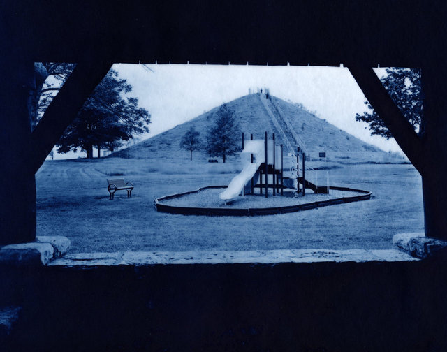
Camden Park, Huntington, West Virginia - 2005
Camden Park was constructed in the early 1900’s, when a railroad was built between Huntington, West Virginia and Ashland, Kentucky. In the park’s heyday, a bandstand stood atop the mound, which is Adena in origin. Pavilions within the park are named for the Hopewell, Adena and Woodland Cultures. New Cyanotype Print on Wyndstone Vellum from the original 8"x10" negative
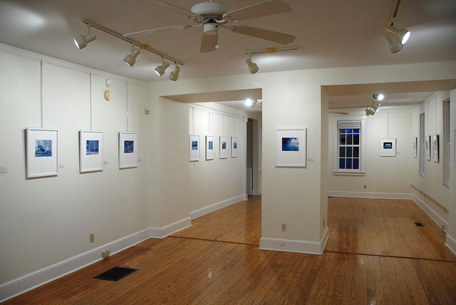
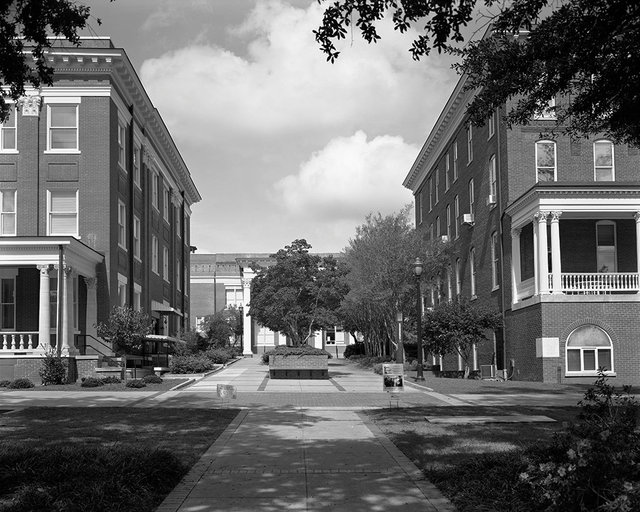
Unearthed Exhibition
Sea Islands Center Gallery, University of South Carolina Beaufort, January 17 - March 2, 2014
Unearthed Exhibition
Sea Islands Center Gallery, University of South Carolina Beaufort, January 17 - March 2, 2014
Unearthed Exhibition
Lykes Atrium Gallery, Washington and Lee University, Lexington, VA, 2013 Photo credit: Liz Liguori
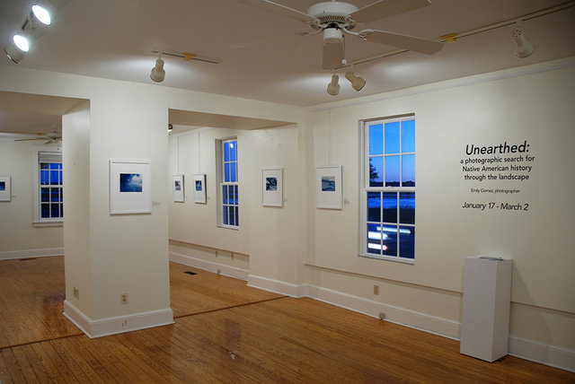
Unearthed Exhibition
Unearthed, Lykes Atrium Gallery, Washington and Lee University, Lexington, VA, 2013 Photo credit: Liz Liguori
Former Site of Georgia Penitentiary, Milledgeville, Georgia, 2012
This photograph shows the former site of the main gate to the Georgia Penitentiary at Milledgeville. In 1831, Samuel Worcester and Elizur Butler, two northern missionaries who lived on Cherokee territory were sentenced to two years of hard labor at the penitentiary. This was a result of an 1830 law forbidding white people to reside on Cherokee land. Worcester and Butler appealed their case, Worcester v. Georgia, to the U.S. Supreme Court in 1832. The court ruled in their favor, agreeing that the U.S. government did not have jurisdiction to dictate who could live on Cherokee land, as the Cherokee were an independent and sovereign nation. President Andrew Jackson did not enforce the decision, so the missionaries remained in the penitentiary until their release by Governor Lumpkin a year later. Jackson’s lack of support for the ruling hastened Cherokee removal to Indian Territory, the Trail of Tears. Today, this is the site of Georgia College. 16x20" Archival Pigment Print from the original scanned 8"x10" negative on Museo Silver Rag. Framed size: 26x22"
Replica of the Cherokee Phoenix Print Shop, New Echota State Historic Site, Calhoun, Georgia, 2012
After Sequoyah’s introduction of the Cherokee syllabary, a print shop was established at New Echota, where a newspaper called the Cherokee Phoenix was printed in both English and Cherokee. The Cherokee were the first American Indian nation to create a written language. They continue to publish their newspaper in Tahlequah, Oklahoma. 16x20" Archival Pigment Print from the original scanned 8"x10" negative on Museo Silver Rag. Framed size: 26x22"
Foundation of Elias Boudinot’s House, New Echota State Historic Site, Calhoun, Georgia, 2012
New Echota was the capital of the Cherokee Nation from 1825 to 1838. The Treaty of New Echota, which led to the Cherokee Trail of Tears, was signed here at Elias Boudinot’s house. 16x20" Archival Pigment Print from the original scanned 8"x10" negative on Museo Silver Rag. Framed size: 26x22"
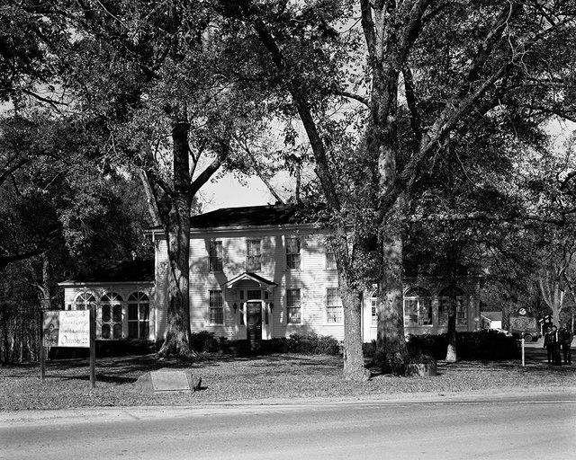
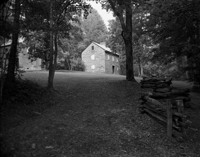
Major Ridge House, Rome, Georgia, 2005
The home of Major Ridge, a Cherokee leader who fought alongside Andrew Jackson in the Creek and First Seminole Wars, is today preserved as the Chieftain’s Museum in Rome, Georgia. He prospered as a planter and a ferryman, owning a vast plantation and enslaved people. Under increasing pressure for Cherokee relocation to Indian Territory from the U.S. government, Ridge, betrayed by the society to which he tried to adapt, helped draft and sign the Treaty of New Echota. He believed that the only way for the Cherokee to ultimately survive as a nation was to relocate. 16x20" Archival Pigment Print from the original scanned 8"x10" negative on Museo Silver Rag. Framed size: 26x22"
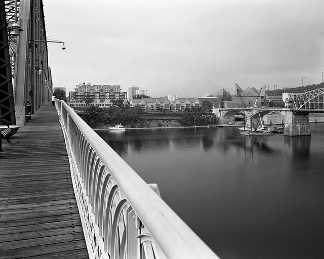
Ross's Landing, Chattanooga, Tennessee, 2007
Ross’s Landing (the shoreline between the two bridges) was a departure point for many Cherokee people who were forcibly removed from their land on the “Trail of Tears” in 1838. 16x20" Archival Pigment Print from the original scanned 8"x10" negative on Museo Silver Rag. Framed size: 26x22"
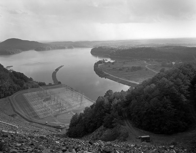
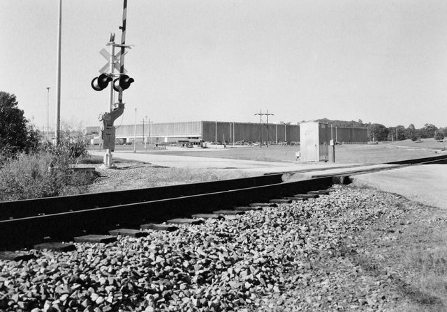
Coosawattee Town, Ellijay, Georgia, 2009
This photograph shows the switchyard and powerhouse below Carter’s Lake Dam, which was built by the Army Corps of Engineers in 1977. The dam and lake are on the former site of Coosawattee Old Town, a major Cherokee town at the time of removal in 1838. The Cherokee were removed from this area to nearby Fort Hetzel and then to Tennessee, where they began their journey to Indian Territory, or present day Oklahoma.
Cherokee Corner, Oglethorpe County, Georgia, 2005
Scanned 8"x10" negative
Oconee Station, Walhalla, South Carolina, 2006
Oconee Station was one of many forts used as a defensive post against attack from Cherokee and Creek Indians. Scanned 8"x10" negative
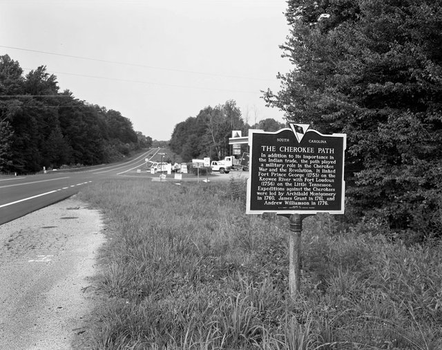
The Cherokee Path Historical Marker, Salem, South Carolina, 2006
Scanned 8"x10" negative
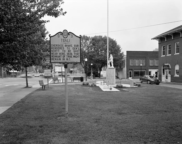
Tsali Historical Marker, Bryson City, North Carolina, 2006
Scanned 8"x10" negative
Tugaloo Town, Toccoa, Georgia, 2006
Tugaloo was a principal Cherokee town destroyed during the American Revolution and later inundated by Lake Hartwell. Scanned 8"x10" negative
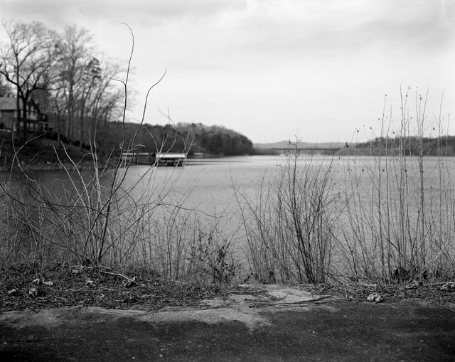
Tugaloo Town, Toccoa, Georgia, 2014
Scanned 8"x10" negative
Quadranaou Mound, Marietta, Ohio, 2005
The Quadranaou Mound is part of a larger complex of mounds called the Marietta Earthworks. It is also known as Camp Tupper because of its use as a civil war campsite. 16x20" Piezography Print from the original 8"x10" on Hahmemuhle Photo Rag 308. Framed size: 26x22"
Great Mound, Mounds State Park, Anderson, Indiana, 2010
The Great Mound is one of several earthworks known as the “Anderson Mounds”. This area is believed to have been a ceremonial center for the Adena and Hopewell people. Scanned 8"x10" negative
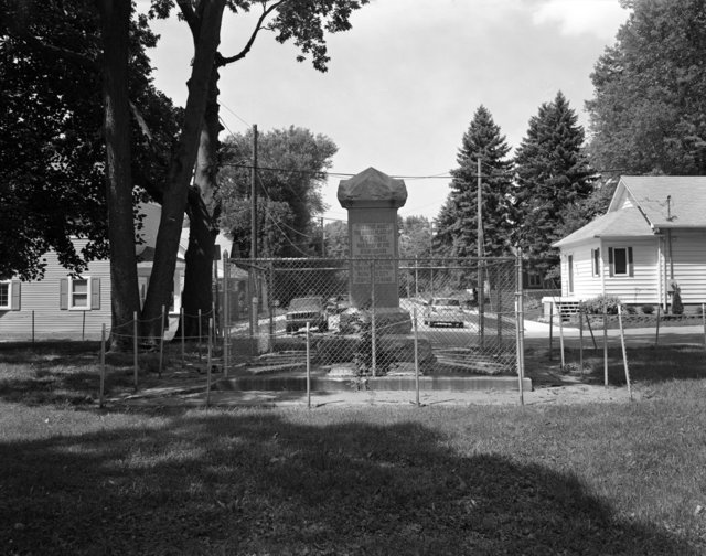
Kokomo Memorial, Kokomo, Indiana, 2010
This is a monument to the man for whom the city of Kokomo was named and to the early settlers and Civil War veterans of the city. The monument describes Kokomo as “Warrior Chief of the Miami Nation”, though there is speculation as to Kokomo’s true identity and true burial site. Scanned 8"x10" negative
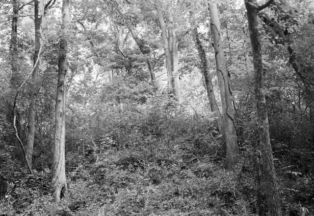
Island Creek Mound, Manchester, Ohio, 2005
This mound, covered with trees and undergrowth, has not been excavated, so its origin is unknown. It is located on public boat launch grounds along the Ohio River. Scanned 8"x10" negative
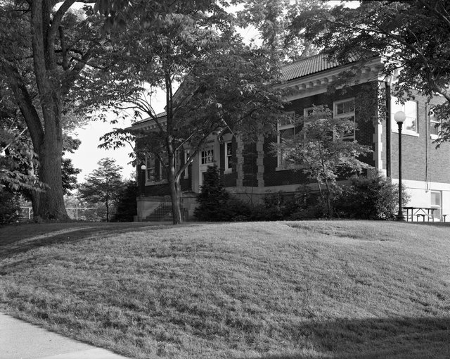
Capitolium Mound, Marietta, Ohio, 2005
This mound is part of the "Marietta Earthworks" complex built between 100 BCE and 500 CE. In 1916, the Washington County Library was built on its summit. Scanned 8"x10" negative
Conus Mound, Mound Cemetery, Marietta, Ohio, 2005
Scanned 8"x10" negative
Great Temple Mound, Ocmulgee National Monument, Macon, Georgia, 2008
Ocmulgee is the Former Capital of the Muskogee (Creek) Nation. The Muskogee people were forcibly removed from the area in the 1820’s. Scanned 8"x10" negative
Lamar Spiral Mound, Macon, Georgia – 2004
The Lamar Mound is known as a spiral mound because of the spiral ramp that once led to its summit. It is one of only two spiral mounds left in the U.S. Currently, funds are not available to halt its continued erosion. Malde-Ware Platinum/Palladium Print from the original 5"x7" negative on Crane's Platinotype Paper 21”x17” Framed
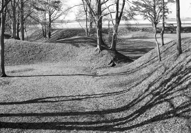
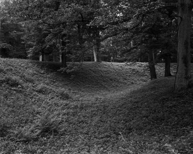
Etowah Defensive Ditch, Etowah Indian Mounds, Cartersville, Georgia, 2003
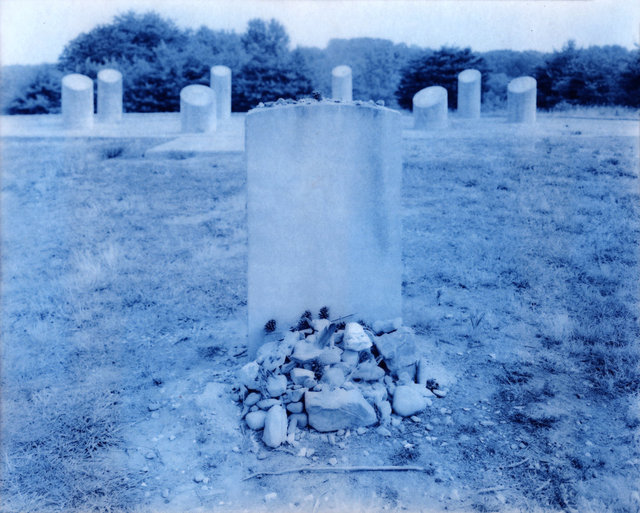
Trahlyta’s Grave, Lumpkin County, Georgia – 2004
Malde-Ware Platinum/Palladium Print from the original 5"x7" negative on Crane's Platinotype Paper
Westpoint-Stevens Plant, Oconee County, South Carolina – 2004
At the time of this photograph, this building stood on the former site of the Cherokee Town of Esseneca. Malde-Ware Platinum/Palladium Print from the original 5"x7" negative on Crane's Platinotype Paper
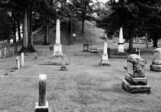
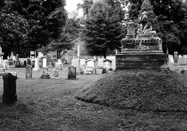
Mound Cemetery, Marietta, Ohio – 2004
The Conus Mound at Mound Cemetery is pictured here. It is believed to be Adena in origin. Malde-Ware Platinum/Palladium Print from the original 5"x7" negative on Crane's Platinotype Paper
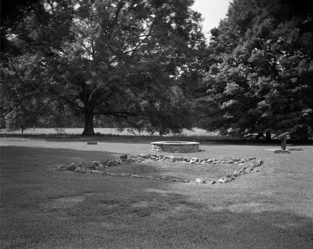
Mound Cemetery, Marietta, Ohio – 2004
This grave was built on a mound designed to mimic the Adena Burial Mound seen in the background of the photograph. Malde-Ware Platinum/Palladium Print from the original 5"x7" negative on Crane's Platinotype Paper